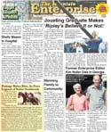
Top, Katy Penland and Lynn Stafford (l-r) review maps and documents from the Tejon Mountain Village Condor habitat plan. Bottom, Penland has been carefully reviewing the documents over five weeks. She has disappointing news.
Tejon Mountain Village Special Report and Commentary
Download the complete report (Parts 1 and 2) as a PDF file.
By Patric Hedlund with Katy Penland
On March 6 an 18-pound box was delivered by Federal Express to The Mountain Enterprise from the United States Fish and Wildlife Service (FWS). It wasn’t a lead meteorite from outer space or an orphaned bear cub, but it was as heavy
Inside the box was the hard copy of a four-volume set of documents that, if printed from the online version at the FWS website, would total 5,200 pages of maps and data—equal to 10 reams of paper. This is the “Tehachapi Uplands Multispecies Habitat Conservation Plan” (HCP).
The window for public comment during this phase of the permitting process closes on May 5.
We requested these printed and bound documents so we could report to the public about what is contained in Tejon Ranchcorp’s plans for endangered and threatened species whose critical habitat happens to be where the developers wish to build Tejon Mountain Village. The box also contained the HCP’s companion document, called the draft Environmental Impact Statement (EIS). The National Environmental Policy Act (NEPA) requires that the federal agency analyze the impact of the developer’s habitat conservation plan in the EIS.
So, early in March, we allocated several hours a week of a reporter’s time to review the documents. Katy Penland was methodical, taking careful notes, starting with the condor section of the plan. Very quickly she ran into an unexpected barrier. When we placed the maps side by side and began reviewing the text of the HCP, comparing text in one section to that in another, then comparing the text to the maps, and maps to maps, we began finding significant discrepancies and contradictions in the HCP documents, making it virtually unintelligible.
We expected that the draft EIS, in its critical analysis, would point out these errors and comment upon them, but when we checked, we found they did not. Worse, the draft EIS introduces layers of new contradictions.
Both the draft EIS and HCP (and their maps) fail to use consistent labeling nomenclature, make errors in simple arithmetic, present conflicting references to critical habitat for the California Condor and equally confused references to plans for Tejon Mountain Village.
We asked a professional conservation biologist to review our findings. Lynn Stafford has 19 years of experience as a professional consultant in field biology, much of it working with environmental regulatory documents. We sought to verify whether what we marked as “fatal flaws” will indeed make it nearly impossible for the public to read and comment on the plan.
Detailed notes of some of our findings appear below so our readers can see for themselves the problems presented in these documents at the most preliminary level.
Commentary:
After 100 hours of effort among three people, we conclude these documents have not been proofread responsibly. They appear to have been prematurely released to the public for comment. As reporters, this is a disappointment. The stakes are high for the developer, for the endangered species and for the people of California.
We’ve been told that years have been spent developing these plans. The cost may be several million dollars. The consulting firm which prepared the HCP (“with technical assistance from U.S. Fish and Wildlife Service”) is named DUDEK. Peter Bloom of Bloom Biological, Inc. is the wildlife biologist (but not a condor specialist) who prepared the condor habitat conservation and management section. The DEIS was prepared for FWS by ICF Jones & Stokes.
Meanwhile, we’ve learned of at least two parties, the Center for Biological Diversity (CBD) and the TriCounty Watchdogs, that have asked for the public comment period to be extended.
More time may not be the answer. Recall and reissue, after proofreading and correction, may be needed.
We were told by Lois Grunwald of FWS on January 23, “This notice slipped through from EPA…we weren’t prepared to issue our document..but we were told to release this because it was publicized in the Federal Register today.”
If these reports were rushed through the federal pipeline despite the two-day-old Obama administration’s order to freeze such releases pending review, perhaps they are not finished documents.
FWS and Tejon Ranchcorp have been asked to respond to our preliminary findings. Next week we will carry their replies.
As we were going to press, Lois Grunwald from the Fish and Wildlife Service asked us to include this note from her: "Public participation is important. We encourage anyone with an interest to read the draft conservation plan and DEIS and provide us with their comments."
Go to www.fws.gov/ventura or write the Ventura Fish and Wildlife Office to see the documents.
Comment on the proposals and draft EIS by email at fw8tumshcp@fws.gov or to Mary Grim, [USFWS Pacific-Southwest Regional Office, 2800 Cottage Way, Rm. W-2606, Sacramento, CA 95825], or to Steve Kirkland at the Ventura Fish and Wildlife Office [2493 Portola Road, Suite B, Ventura, Calif. 93003].
A Preliminary Sampling of Discrepancy Notes
Introduction:
Katy Penland, who has worked with the U.S. Forest Service, Department of Commerce and government contractors on wildlife surveys, and has directed a conservation organization prior to working as a reporter, alerted the editor and publisher of The Mountain Enterprise that preliminary review of Tejon Ranchcorp’s Tehachapi Upland Multispecies Habitat Conservation Plan (TUMSHCP or HCP) and the draft Environmental Impact Statement (EIS) documents released for public comment by the United States Fish and Wildlife Service (FWS) contained contradictory labels, inconsistent naming protocols and basic errors which present a steep barrier to the public’s ability to comment on the data presented in 5,200 pages of maps and text.
Lynn Stafford, a professional field biologist, was asked by The Mountain Enterprise to help the editor review Penland’s initial findings regarding discrepancies in the HCP and DEIS. Stafford has been working with government and industry habitat analysis documents for 19 years. He provides professional environmental monitoring and biological surveys from the field for large infrastructure construction projects such as dams, highways and power plants. We asked him to review, step by step, page by page, Penland’s initial findings.
Here is a sampling of these notes, to illustrate the nature of the discrepancies we found throughout the documents in our preliminary survey of the sections referring to the California Condor. We conclude that such flaws—which proofreading and correction could have addressed before release to the public—present an effective barricade against public comment on the data presented in the sections of the DEIS and the HCP we’ve attempted to review so far. This raises a substantial concern that such internal contradictions may impact the validity of the process of public review itself.
The public comment period for the draft documents closes on May 5. Our time has been consumed in reporting fundamental discrepancies in the documents rather than being able to report the terms and conditions proposed by Tejon Ranchcorp to justify 50-year "take" permits for each of 27 species, including the endangered California Condor.
The question that emerges from this first level review relates to FWS responsibility under its National Environmental Protection Act guidelines: Is it lawful for FWS to move into the next section of the permitting process if this preliminary public comment phase is fundamentally flawed?
Sampling of Discrepancies
In sections of the discrepancy notes presented here, we include some of Stafford’s vetting statements from March 30 review.
I. DISCREPANCIES BETWEEN MAPS AND TEXT IN HCP
1) The California Condor Conservation and Management Plan (“Condor Plan”): On pg. 36, reference is made to the “TMV Specific Plan” being a “7,800 ac. area” in which development would occur within the “Planning Area boundary.” On pg. 22, the “TMV Planning Area’ is stated to be “26,417 ac.” On pg. 4, the phrase “proposed development” is stated as being 7,900 ac. “associated with TMV.”
Stafford: They state the TMV planning area as 26,000 acres and then they state the opposite of what the maps show insofar as the acreages. The text indicates that the TMV planning area is more than three times larger than the TMV specific plan whereas the maps show the reverse. Yellow on map 4-9 (referred to on 4-9 as "proposed development") is the same as orange on map 4-6 referred to as "TMV Planning area." There is much more proposed development shown on Map 4-9 than just TMV.
On page 22, it says the TMV planning area encompasses 26,000 acres. That is not matching. Unfortunately, the maps don’t show acreage, so we can only make relative comparisons.
Everything that Katy has written above here is true. I have not found anything that does not check.
2) However, in Fig. 4-6, the area labeled “TMV Planning Area” (26,417 ac.) is much smaller and wholly contained within the “Specific Plan boundary” (7,800/7,900 ac.). Fig. 4-9 shows a “proposed development” (which is the same shape and location as Fig. 4-6’s “TMV Planning Area”) also as wholly within the “TMV Specific Plan Boundary.”
3) In other words, Pgs. 4, 22 and 36 state the opposite of what the maps show. And at least one map uses a different naming convention to label the actual TMV development.
Stafford: This summarizes everything found factually above.


4) Additionally, Fig. 4-10 [below] shows that a majority of the “TMV PLANNING AREA” falls within designated “Condor Critical Habitat” (CCH).
Stafford: According to the map, that is accurate….. In Figure 4-10 Condor Critical Habitat shows that the TMV Planning area (IN RED) is what on Fig. 4-9 is called the TMV SPECIFIC PLAN and on Fig 4-9, they do not show TMV Development area as an isolated labelled area. Color convention is not consistent between the maps.

5) Within the HCP "Definitions" section, Condor Critical Habitat is not defined in the documents we reviewed. According to pagination, there are no pages missing. Nonetheless, the term "Condor Critical Habitat" is used in both the maps and the text of the HCP.
Stafford: Figures 4-9 and 4-6 show that the majority of the TMV proposed development area is shown to be within areas which are labelled as Condor Critical Habitat.
II. DISCREPANCIES BETWEEN MAPS AND TEXT IN THE DEIS, which is (under the National Environmental Policy Act) to be the U.S. Fish and Wildlife Service analysis of the HCP: But in the DEIS there is no reference to Condor Critical Habitat at all (despite the fact that the term is a FWS designation). The DEIS uses only the term "Condor Study Area" which is "apples and oranges," in that it is a much smaller area than Condor Critical Habitat. Therefore, comparing the maps and text presentation of the DEIS with the HCP in this vital subject regarding condor range is not possible.
1) In a first look at the Draft Environmental Impact Statement (DEIS) to assess its four proposed alternatives and to see how thoroughly it analyzes the Tehachapi Multispecies Upland Habitat Conservation Plan (HCP), comparisons between the maps of the DEIS and HCP are necessary. However, this has been rendered impossible as 61 out of 65 DEIS maps depict only the 37,099-acre Condor Study Area (CSA) whereas the HCP (pg. 3 of Appendix C, the “Tejon Ranch California Condor Conservation and Management Plan”) refers to the much larger 131,947 acres of Condor Critical Habitat (CCH) that fall within the boundary of Tejon Ranch.
[NOTE: The DEIS uses a figure of 132,043 acres [DEIS pg. 3.1-10], and the HCP uses yet another figure of 132,009 acres (pg. 4 of Appendix C, the “Tejon Ranch California Condor Conservation and Management Plan”). Further, there is a discrepancy between the DEIS and HCP for the total condor critical habitat acreage distributed throughout California as designated by the US Fish & Wildlife Service: HCP says that acreage is 605,190 (pg. 3 of Appendix C) and the DEIS says 570,400 acres (pg. 3.1-10).]2) The distinction between CSA and CCH is important because according to the DEIS maps, the planned Tejon Mountain Village (TMV) development and other land uses such as mining and other commercial and industrial development lie wholly outside the CSA, potentially giving the impression that there will be minimal, if any, impact on at least one critically endangered species, the California Condor. However, the proposed TMV development, the Industrial Site Complex and some of the above-mentioned land uses—while outside the CSA—do not lie outside of the CCH. In fact, according to the HCP maps, most of the proposed land development, except Centennial, falls well within the CCH (critical condor habitat) boundary.
3) Of the four maps in the DEIS where condor critical habitat is shown, only two show the spatial relation to Tejon Mountain Village planned development (Figs. 4.1-1 and 4.1-2).
3a) However, Fig. 4.1-1 repeats the same error that occurs in the HCP by reversing the names of the “Specific Plan Boundary” and “TMV Planning Area Development.” (Other DEIS maps that repeat this naming error are Figs. 2.7 and Fig. 2-8 [sic].)
4) Fig. 4.1-2 uses one color for all “Development” without identifying the individual development lands (TMV, Centennial, National Cement, Industrial Site Complex, etc.). For those of the public who may already know the shapes of these current and proposed development footprints, this map corroborates that most of the TMV and Industrial Site Complex developments fall within Condor Critical Habitat.
5) Because these DEIS maps do not show CCH but only the smaller CSA, it is difficult to see how the public can assess how large an encroachment all the proposed developments, land uses and utility easements will have on Condor Critical Habitat, thus calling into question the effectiveness of commenting on which of the four “proposed alternatives” might have the least impact.
6) Further, “Condor critical habitat” is not referred to anywhere in the 528 pages of text of the DEIS except for one historical note regarding the 1992 release of the first two condors into “critical condor habitat” in the Sespe-Piru California area (DEIS, pg. 3.1-11). Thus, there is no discussion of the cumulative effects all the proposed development and land uses will have on at least this one endangered species’ critical habitat regardless of which alternative is chosen.
7) The maps themselves are extremely difficult to read even at their 11” x 17” size. The multiplicity of similar colors used in the legends and on the maps to differentiate miniscule parcels of land only further complicates analysis of the four alternatives (e.g., Figs. 2.9, 2.10, 2.11). There are also errors in the legends where colors are used that don’t occur on the map (e.g., Fig. 3.7-4), or where one color is specified in the legend but a different color is used on the map (e.g., Fig. 2-1). One map is unreadable, obviously reproduced from a low-resolution image (Fig. 4-11 in the HCP).
III. INCONSISTENCIES REGARDING SIZE OF PROPOSED DEVELOPMENT
1) In the DEIS, pgs. 2-11 thru 2-12 (Sec. 2.3.3.1.3 “Commercial and Residential Development Activities”) break down the acreages and footprints of the proposed developments.
In the first subsection called Tejon Mountain Village Planning Area, it says, “The TMV Planning Area is composed of three primary components: the TMV Specific Plan Area, a small area west of I-5, and the Oso Canyon area.”
1a) The “TMV Specific Plan Area” is, according to the DEIS, “26,417 acres of the 28,253-acre TMV Planning Area,” which contradicts what the HCP says.
1b) As discussed above, the HCP says that the “Specific Plan Area” is 7,800/7,900 acres [a conflict within the HCP text itself] and the “Planning Area” is 26,417 acres. But here again, the internal HCP maps further contradict the HCP text, labeling these two areas the opposite, showing the “Specific Plan Area” to be bigger [26,417 acres] than the “Planning Area” [7,800/7,900 acres] within which it ostensibly resides.)
2) Back to the DEIS: It says that the “TMV project would include up to 3,450 residences, up to 160,000 s.f. of commercial development, two golf courses, an equestrian center, up to 750 hotel rooms, and up to 350,000 s.f. of support uses…” (italics mine to indicate that ‘TMV Project’ is being used as a catch-all term that combines "Specific Plan" and "Planning Area" components)
2a) On the DEIS map (Fig. 2-10), this “small area west of I-5” shows three different patches of the same color, which the map’s legend identifies only as “accepted county plan area.” The total is 153 acres which will support “approximately 173 dwelling units and 304,920 s.f. of commercial space.” (These three patches are not contiguous, the first of which appears due west of Castac Lake and the next two farther north, which appears to be due west of the school and the Tejon Ranchcorp headquarters—all three areas of which are “west of I-5.”) The DEIS also states "no development plans currently exist for this portion of the TMV Planning Area west of I-5." (italics mine)
2b) The next subsection called Lebec/Existing Headquarters says, “TRC has no current development plans for this area. Development of up to nine dwelling units and 1,339,470 s.f. of commercial development would be consistent with the Kern County General Plan…” (italics again mine. ALSO NOTE: There is a tiny pink area on the map that, I believe, is where the headquarters is located although it isn’t labeled as such, only that “specific plan required” presumably should development plans materialize.)
2c) The whole section concludes with “a total of 3,633 dwelling units and 1,804,390 s.f. of commercial space is assumed…” and “would result in a disturbance area of approximately 5,533 acres, or 4% of the Covered Lands.”
Stafford: it sounds like a controversy comes from what the actual acreage of the development is. Are they counting as "open space" all the acreage that they area selling to homeowners? They come up with a ridiculously small "disturbance area"—5,533 acres of being disturbed or 4%.
2d) 3,450 “residences” + 173 residences west of I-5 + up to 9 “dwelling units” = 3,632 units, not 3,633 (math error by professional consultant). Stafford: Apparently these are areas already shown within the Kern County General Plan; it says Tejon Ranch has no current development plans for this area. 1,339,470 sq ft. of commercial development would be consistent with the Kern County general plan (Stafford:That is over 100 acres)
3) 160,000 s.f. commercial + 304,920 s.f. commercial = 464,920 s.f. commercial, not 1,804,390 s.f.. How did the DEIS arrive at this figure? By adding the 1,339,470 s.f. commercial space in Lebec/TRC Headquarter area that TRC states “has no current development plans.” They included a figure for which no current development plans are in place but have not added the 350,000 s.f. (30 acres) of “support use” that is required for the current commercial hotel/resort’s support activity? How is this hotel support space not commercial? Is it misleading to call more than a third of a million square feet of a commercial hotel’s footprint as “support use”?
Stafford: I have two related questions: Is this acreage accurate? Katy Penland asks if they include the hotels and golf courses within that. Second: What is the definition of "disturbance area?" Some of these are 20 to 80 acre parcels. But does "disturbance area" include discussion and consideration of urban-wildland interface disturbance analysis? "Disturbance" of habitat increases with the amount of interface—many separate chunks with different uses creates much greater interface disturbance. There is a significant difference in the habitat value of uninterrupted acreage and "greenbelt" acreage. They are not equivalent when it comes to the ability of wildlife to use the areas. In addition, if there are homes here, there will be collateral disturbance, such as fuel reduction to protect homes from fires, the tendency of wild animals to stay away from human habitation, the impact of the homeowners’ domestic animals, including dogs and cats, foraging in the areas, and the tendency of wild animals to "get in trouble" when they find a food source close to homes due to homeowners activity and the owner then calls for control measures by federal and state agencies (to remove and often kill wildlife that has strayed into the area). This should all be taken into consideration if we are to be accurate in our discussion of "disturbed area." We need to examine the breadth and depth of the [cumulative interface acres] in order to speak about "disturbed area" accurately.
Conclusion and Question:
The above sampling of notes reflect only a superficial preliminary overview of the sections of these documents specific to the California Condor, neglecting inquiry at this time into 26 other species. Our goal in publishing this sampling of notes is to bring to the attention of all parties—the public, the United States Fish and Wildlife Service, our state, local and national government representatives and the developer—to this question: When the agencies involved have released significantly flawed documents to the public with a ticking clock within which the documents are to be examined and commented upon, what does the notion of "public comment" and a "public comment period" really mean?
_____________________
Note: In various documents, Tejon Ranchcorp identifies itself as Tejon Ranch Company, Tejon Ranchcorp and Tejon Ranch Corporation.
Read Part 2 of the Tejon Mountain Village Special Report
This is part of the May 08, 2009 online edition of The Mountain Enterprise.
Have an opinion on this matter? We'd like to hear from you.