Image 1 of 2
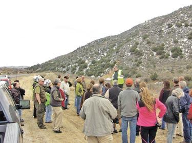
About 50 people attended the first tour. A second tour is set to start Saturday, Feb. 23, at 10:30 a.m. at Coffee Cantina (3011 Mt. Pinos Way, Frazier Park). There is a $35 fee.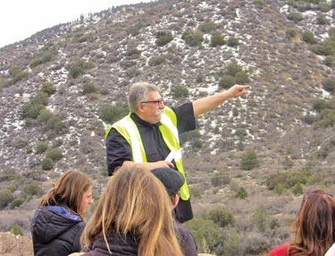
Image 2 of 2
Kuepper points out the darker brown color of the rocks and soil on the Pacific Plate (south of Frazier Mountain Park Road) compared to the lighter-colored earth of the North American Plate (north of the roadway), demonstrating how the plates have shifted past one another over millions of years.
About 40 Emergency Management professionals from Los Angeles County joined Frazier Park’s Gunnar Kuepper for a tour of the San Andreas Fault on Saturday, Feb. 16. "The focus of the tour is the San Andreas Fault system and the effect earthquakes have on creating amazing landscape, as well as the potential effects on critical infrastructure such as transportation, utilities and water supply," Kuepper explained. All the villages of the Mountain Communities are built along the fault. Frazier Mountain Park Road, Cuddy Valley Road and Mil Potrero Highway are built along the center of the fault.
This is part of the February 22, 2013 online edition of The Mountain Enterprise.
Have an opinion on this matter? We'd like to hear from you.