
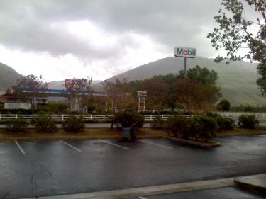
This photo of a dark Mobil station in Grapevine was sent by Elena Abreau shortly after power went out around 11 a.m.
UPDATE (Tuesday, April 20, 2010, 3:30 p.m)—Mountain Communities residents and Interstate-5 travelers are cautioned to drive with extreme caution today as the spring storm has made road conditions hazardous.
Currently, emergency crews are responding to a vehicle rollover into a second vehicle just south of Grapevine Road on the southbound side of the freeway. As of 3:32 p.m. no major injuries have been reported, but a ground ambulance is en route.
Additionally, a vehicle is stuck in the northbound east truck escape ramp and Jim’s Towing is on the way to clear the ramp. Lebec resident and community reporter Chuck Noble called in to say that there was a tractor-trailer on Lebec Road just north of the Lebec exit overcrossing that has run into a section of fencing and knocked it down.
Emergency crews and California Highway Patrol have been extremely busy since the rain began around noon, responding to a solo spinout into the center divider at the Kern County/LA County line shortly after 1 p.m. and a rollover into the center divider near Grapevine Road within the next 30 minutes. By 1:45 p.m. a motorcycle had slid into the center divider at Laval Road in Wheeler Ridge with a male reportedly down on the ground, but no further information was available at the time of this report. Ten minutes later yet another solo vehicle spun out to face the wrong way in northbound traffic at Grapevine Road. See weather forecast below. —Cat Buckles report
According to the National Weather Service, rain with possible snow is supposed to continue through Thursday night. Temperatures are expected to drop below 30 tonight so wet roads may turn to icy roads. Please drive with care.
UPDATE (Tuesday, April 20, 2010, 1:02 p.m.)—Power was restored to Lebec and Grapevine areas at 12:59 p.m.
UPDATE (Tuesday, April 20, 2010, 12:44 p.m.)—Six hundred fourty eight power customers have been affected in the power outage which ecompasses Lebec and Grapevine, according to PG&E spokesman Denny Boyles. Boyles said the power went out at 10:58 a.m., crews on-scene have not been able to determine the cause, but believe it is storm-related. PG&E estimates 1:30 p.m. before power will be restored.
FRAZIER PARK, Calif. (Tuesday, April 20, 2010, 11:30 a.m.)—Reports of a power outage ranging from Lebec down to Grapevine were received at The Mountain Enterprise office today at 11 a.m. Power was out at the Fort Tejon CHP station, at Mabeleen’s Mini Mart and at several homes in Lebec and Los Padres Estates. Frazier Mountain High School, however, had not lost power. An update is being sought from PG&E about the situation.
The following is a weather advisory from The National Weather Service:
The National Weather Service in Hanford has issued a winter-weather advisory above 5,000 feet for snow and strong winds.
It is in effect from 11 a.m. Tuesday to 5 a.m. Wednesday, April 21for the Kern County mountains.
Snow accumulations: Total snow accumulations up to six inches will occur above 5,000 feet.
One to two inches of snow could fall on the higher parts of the Grapevine and Tehachapi Pass tonight.
Elevation: above 5,000 feet. The snow level will fall to around 3,500 feet by Wednesday morning.
Timing: snow will spread into the Kern County mountains by midday, with the heaviest snow this afternoon and tonight.
Locations include: Frazier Park, Pine Mountain Club, Cuddy Valley.
Winds: southwest winds will increase to 25 to 35 mph, with gusts to around 55 mph over the ridges and through the passes this afternoon and continuing through this evening.
Winds will diminish after midnight. These winds will create areas of blowing and drifting snow.
Impacts: people living in or traveling into the Kern County mountains above 5,000 feet should expect delays or road closures. Major roads impacted include Highway 178 through the Walker Pass. Light snow accumulations on Interstate 5 over the Grapevine and Highway 58 through the Tehachapi Pass will create slick road conditions.
Precautionary/preparedness actions: A winter-weather advisory means that periods of snow will cause travel difficulties. Be prepared for slippery roads and limited visibilities, and use caution while driving.
National Weather Service forecast as of 11 a.m.:
Today: Showers likely. Cloudy, with a high near 54. Breezy, with a southwest wind 9 to 12 mph increasing to between 19 and 22 mph. Winds could gust as high as 33 mph. Chance of precipitation is 70%.
Tonight: Rain showers likely before 11pm, then a chance of rain and snow showers. Snow level 5700 feet lowering to 4100 feet. Cloudy, with a low around 30. West northwest wind between 17 and 21 mph, with gusts as high as 26 mph. Chance of precipitation is 60%. New snow accumulation of less than a half inch possible.
Wednesday: A chance of rain and snow showers. Cloudy, with a high near 42. West wind between 15 and 18 mph, with gusts as high as 24 mph. Chance of precipitation is 50%. New snow accumulation of less than a half inch possible.
Wednesday Night: A chance of rain and snow showers. Snow level 4200 feet. Mostly cloudy, with a low around 30. West northwest wind between 11 and 18 mph, with gusts as high as 24 mph. Chance of precipitation is 50%. New snow accumulation of less than a half inch possible.
Thursday: A chance of rain and snow showers. Mostly cloudy, with a high near 46. Northwest wind between 8 and 11 mph. Chance of precipitation is 40%. New snow accumulation of less than a half inch possible.
Thursday Night: A 20 percent chance of showers. Mostly cloudy, with a low around 31.
This is part of the April 16, 2010 online edition of The Mountain Enterprise.
Have an opinion on this matter? We'd like to hear from you.